Through the prohibited zone
Through the prohibited zone |
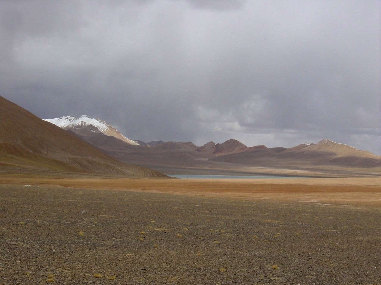
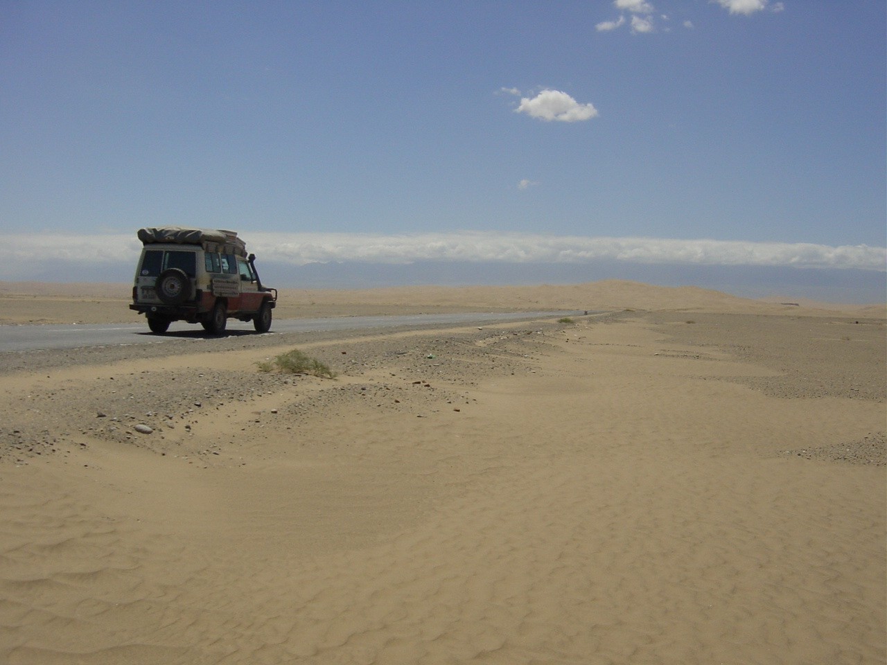
The unusually thorough check at the border at Nyak Co was an indication we were entering the prohibited zone. Another 1,100 kilometers of dusty trail until we get to Kashgar. A vast area even empty of the nomads with their tents and herds of animals. No trace of any other vehicles - only the racing military trucks that make a game of running us off the road. Here the military has the right of way and every other driver is advised to immediately stop at the side of the road when a military vehicle comes into sight. We finally get the idea after we experience a few stones thrown from a truck against our windshield and cooler.
 Ladakh in the background |
 At Karakorum |
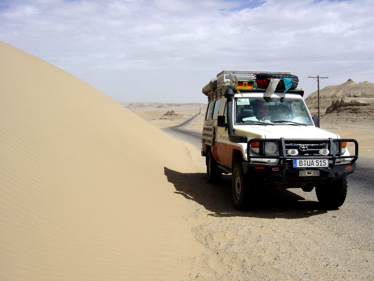
The road runs along a landscape of dry alpine plateau at an altitude of 4,000 to 5,400 meters, the mountain ranges of Ladakh and later the Karakorum (8,611 meters) always at our left. We had in mind to spend the night in Mazar. On the map this place looks really big. As we finally arrive we find a few shacks and some soldiers who meticulously make sure we take no pictures. We decide to drive another 80 kilometers and find accommodations with a road construction brigade who shows us friendly hospitality.
 "Mazar City" |
We have now arrived in the sovereign region of Xinjiang mostly inhabited by Muslims. North of the Tian Shan are Mongolian and Nomad peoples while the Tarim Basin in the south is Islamic-Urban. The ethnic minority in the Chinese sense is the Uiguren living in Xinjiang. In history there are many parallels between Tibet and Xinjiang without the rest of the world giving much notice. We found the Uiguren very friendly and unobtrusive, even if we had to get used to some new (and in part weird) dishes.
Shortly before Kashgar we stopped in the city of Kargilik. It was a wonderful feeling to finally have asphalt under the tires and to get the dust out of the vehicle. Little by little additional damage is revealed from under sediments of dust. The struts and frame of our roof rack are broken, two tires are junk and another can be luckily repaired. Numerous scratches in the finish make our land cruiser look a bit more adventuresome. This can' t be traded for the splendid and impressive experiences that we will not forget from this part of the journey. For the next 6,000 kilometers we (and our land cruiser) can take a pause for breath before we have to get down to business again in the Turkmenistan desert.
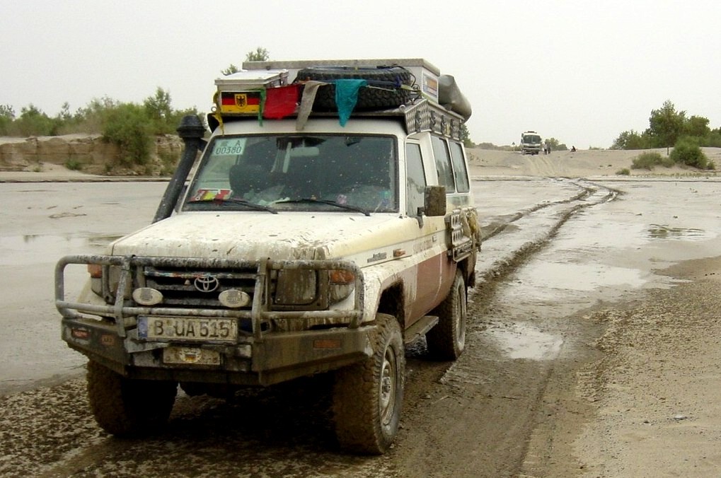
 Our start to the west |
 On the Silk Road 2 |
Our journey begins at the western-most edge of China - in Kashgar. Here the northern and southern routes of the Silk Road meet. When the caravans reached this point they had already gone a treacherous distance through desert and mountains and looked forward to a rest. It isn' t any different for us, even though we are essentially more comfortable traveling in our „motor camel.„ Kashgar is the biggest oasis city in China with its over 4,000,000 inhabitants consisting of a medieval inner town and a hyper-modern Chinese new town. But then at every turn one realizes that Kashgar really is closer to Mecca than Peking. We spend two days here and let the Oriental atmosphere of the great bazaar and the Sunday animal market take effect. Life plays out on the streets so that bakers, shoemakers, blacksmiths and barbers do their business outside. Meals are taken in the cook shops set up outside in front of the houses as well. We give our trust completely to our Uigurian guide.
 Id Kahn Mosque |
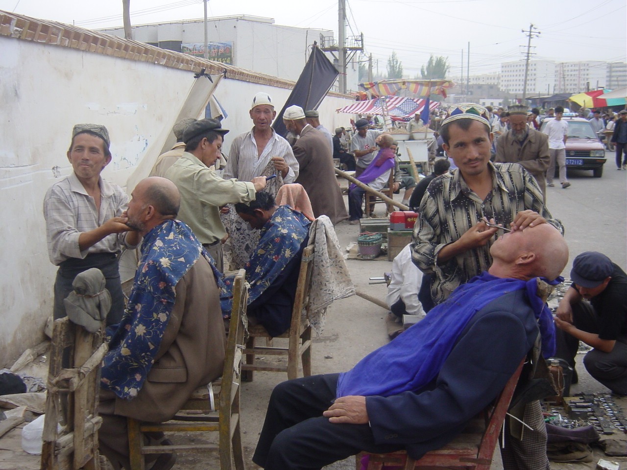 At the barber |
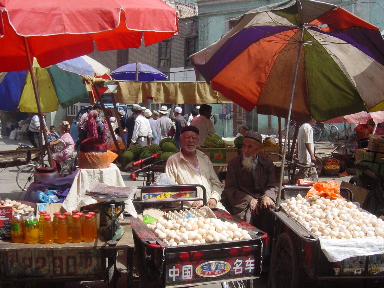 The market |
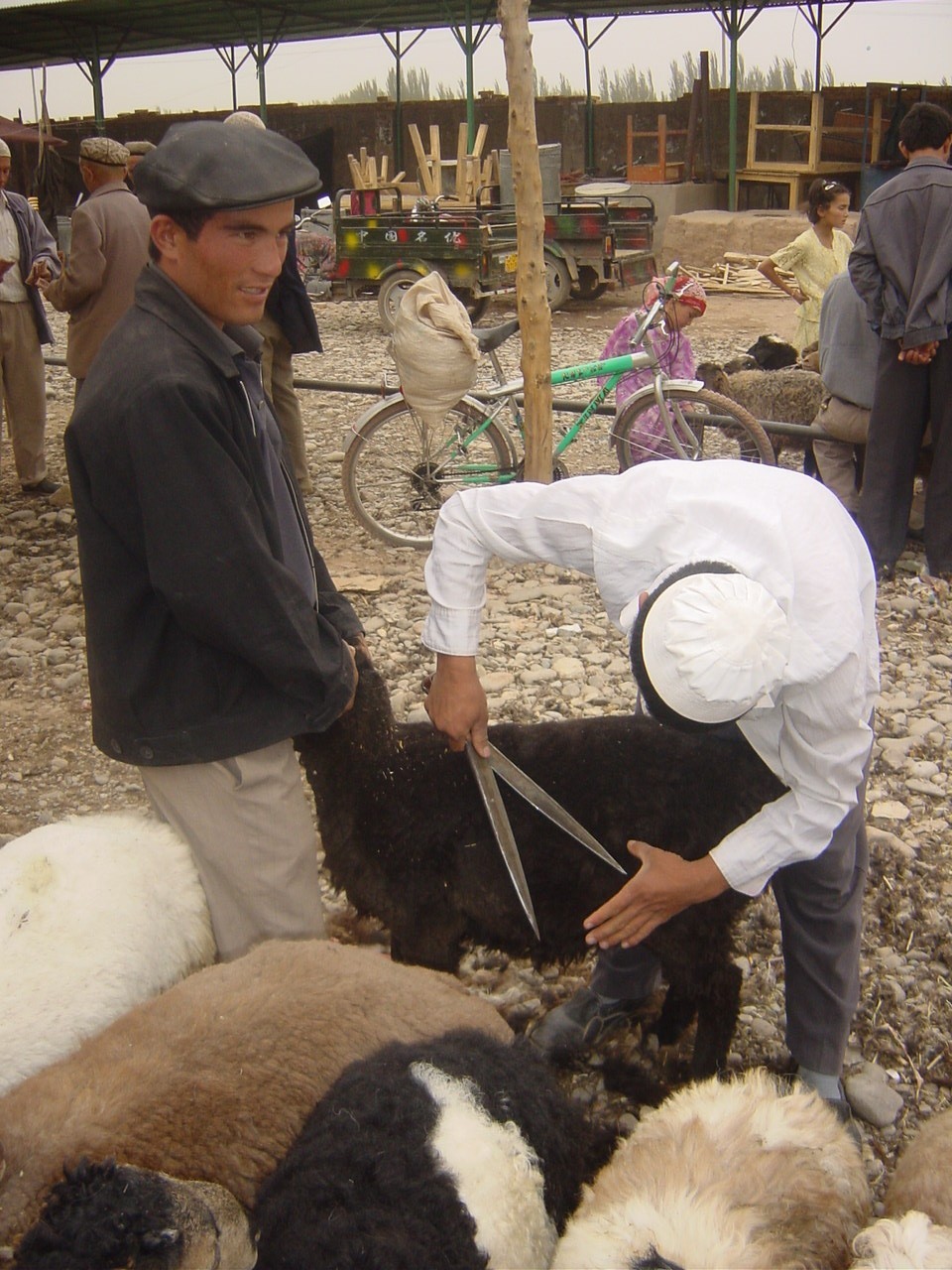 The animal market |
Along the northern Silk Road we reach the city of Aksu. A very modern and clean city. But here we experience for the first time that there are borders even in the Internet. In not one of the Internet cafes is it possible to reach a foreign Website and emails are returned to the sender by Chinese mail providers. After six months we find ourselves for the first time in a genuine „Internet black hole.„ Another small problem is that no English fonts are installed on local computers and thus we cannot open our files. We can' t even send an international fax! We hope that we can work on our Internet reports in the next cities.
We stay for two days in Kuqa. We find the Kizil Grottoes interesting, which we visit because of the over 40°C heat at mid morning. These 1,000 Buddha caves from the 3rd century are the oldest and most western situated grottoes. Of the 236 grottoes, only a few are open to tourists. Photo equipment and backpacks are left outside as in most Chinese tourism sites. In the caves one can only attempt a guess at the previous magnificence of the sculptures and wall paintings. With the expansion of Islam to the east, these Buddhist temples were also destroyed. Archeologists from Germany (from 1902 on Le Coq) and the Cultural Revolution (1966-76) ruined the rest. It is a tragedy when one finds the results of Le Coq' s and his helpers' „research„ as huge holes in the walls where earlier meter-high golden frescoes ornamented the cave walls. In Berlin the majority of these treasures fell victim to the bombs of the Second World War.
 Kizil grottoes |
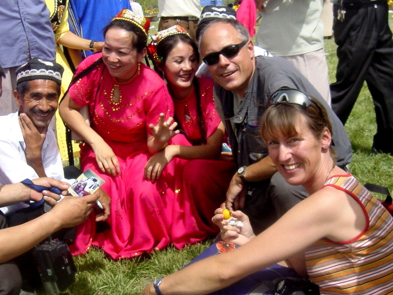
Our next goal is Kuqa, the city of apricots. It is harvest time when the huge Apricot Festival will be celebrated. Every village community from the region shows their best apricots and other products in small exhibition booths. We, as the only tourists, are treated as if we are visitors from another planet and accompanied by a crowd of people. At every opportunity we are offered huge amounts of apricots and melons. What we can' t eat we put away for later.
 Apricot festival 1 |
 Apricot festival 2 |
Not far from Kuqa we visit the ruins of the ancient monastery city of Subashi of the 3rd to 5th century. Not much has remained of the Buddhist city. But then we realize again how far westward along the Silk Road the Buddhist influence had expanded. The Turkish peoples who settled here (the Turkish, Uzbek, Kyrgystans, Kasachs, Arabs, etc.) were initially Buddhists who converted to Islam from the 13th century onward. Buddhists were deprived of the rudiments of their belief when the Muslims destroyed their temples, pagodas and Buddha statues at this time, and as a result their conversion was „accelerated.„
Actually we want to still see the ruins on the other side of the river. Naturally it costs more and a Chinese person has to show us the way. As we stand in front of the raging sand-colored Kuqa River we find our Chinese guide has overextended himself. It seems that he really doesn' t know where one can drive through the river and he estimates that the river is perhaps 70 (!) cm deep or maybe more. We decide with heavy hearts to turn around. Nobody wants to sink his vehicle only because someone wants to find out how powerful a land cruiser is.
On the way back we drive through a small, typical Uigurian village. At the road the women bake herbed bread in a huge clay oven. Immediately we are invited to take a taste. As dessert we are offered the obligatory fresh apricots out of the garden. Then they invite us to their home. Through a big gate we arrive first of all in a courtyard shaded by thick grapevines. The sleeping-living room consists of a huge 18m� bed covered with rugs. Here is where they eat, sleep, celebrate and discuss. We are offered apricots again while we are showing our photo album of pictures of our homeland. Should we come back in the fall they will give us sweet, dried apricots. Our departure is difficult after so much warm hospitality. The best experiences are made away from the usual tourist areas.
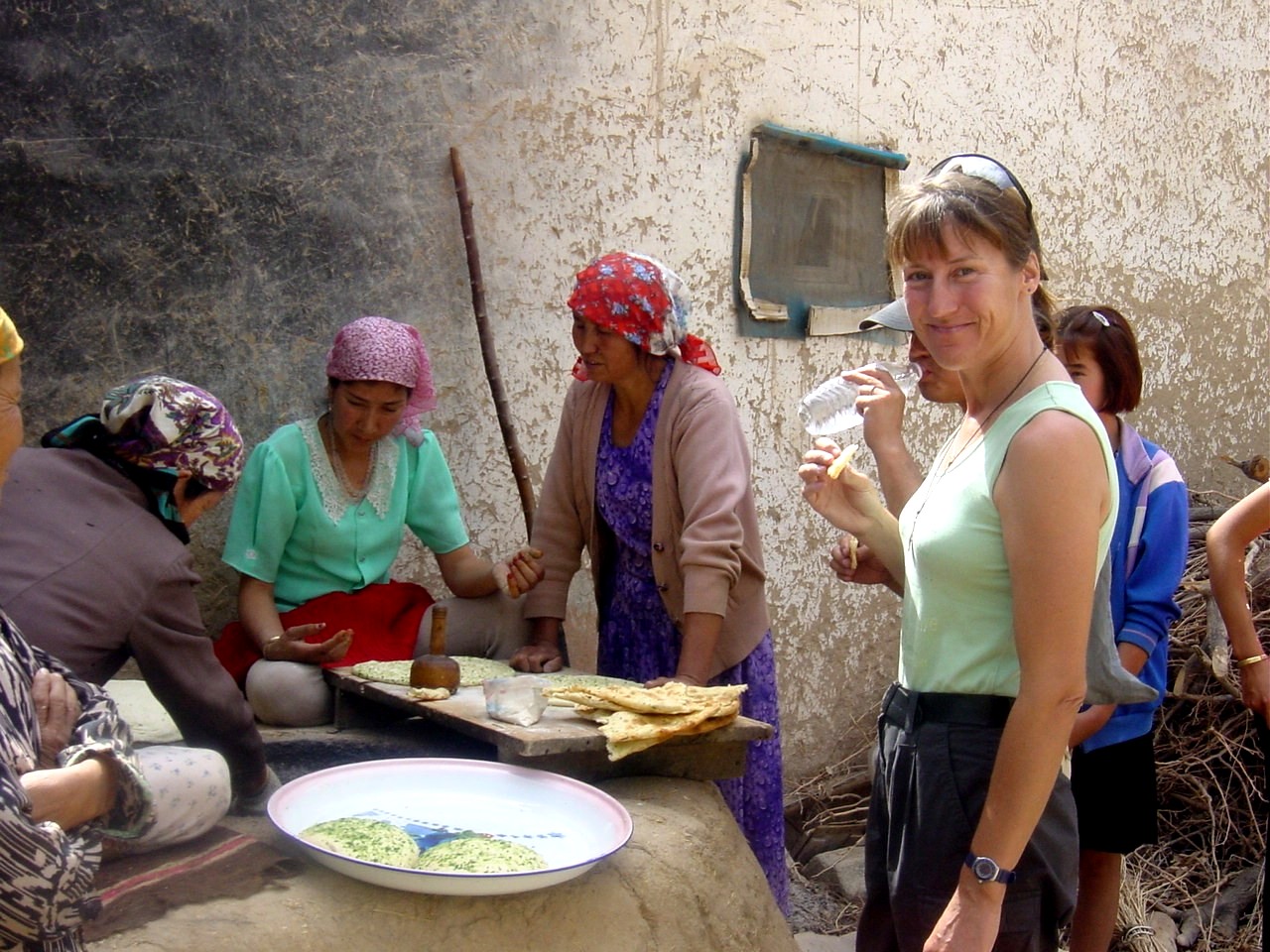 Fresh bread |
Up until now we have been traveling over the north Silk Road along the edge of the great sandy desert of the Takla Makan. Takla Makan roughly translated means „those who go in, never come back.„ We would like to risk a look into the desert and drive 200 kilometers over the new road to the oil fields. Our acquaintance with the desert sand ends at 45°C on sand planks. We find a further exploration too risky without an accompanying vehicle so we turn back. The desert in the last years due to an abundance of crude oil has become extremely important for China' s economy. Everywhere pipelines and oilfields were erected. The workers earn very well in the desert and spend their salaries generously in the surrounding cities. Boomtowns are springing up everywhere with very modern efficient infrastructures. The silk of the future is black.
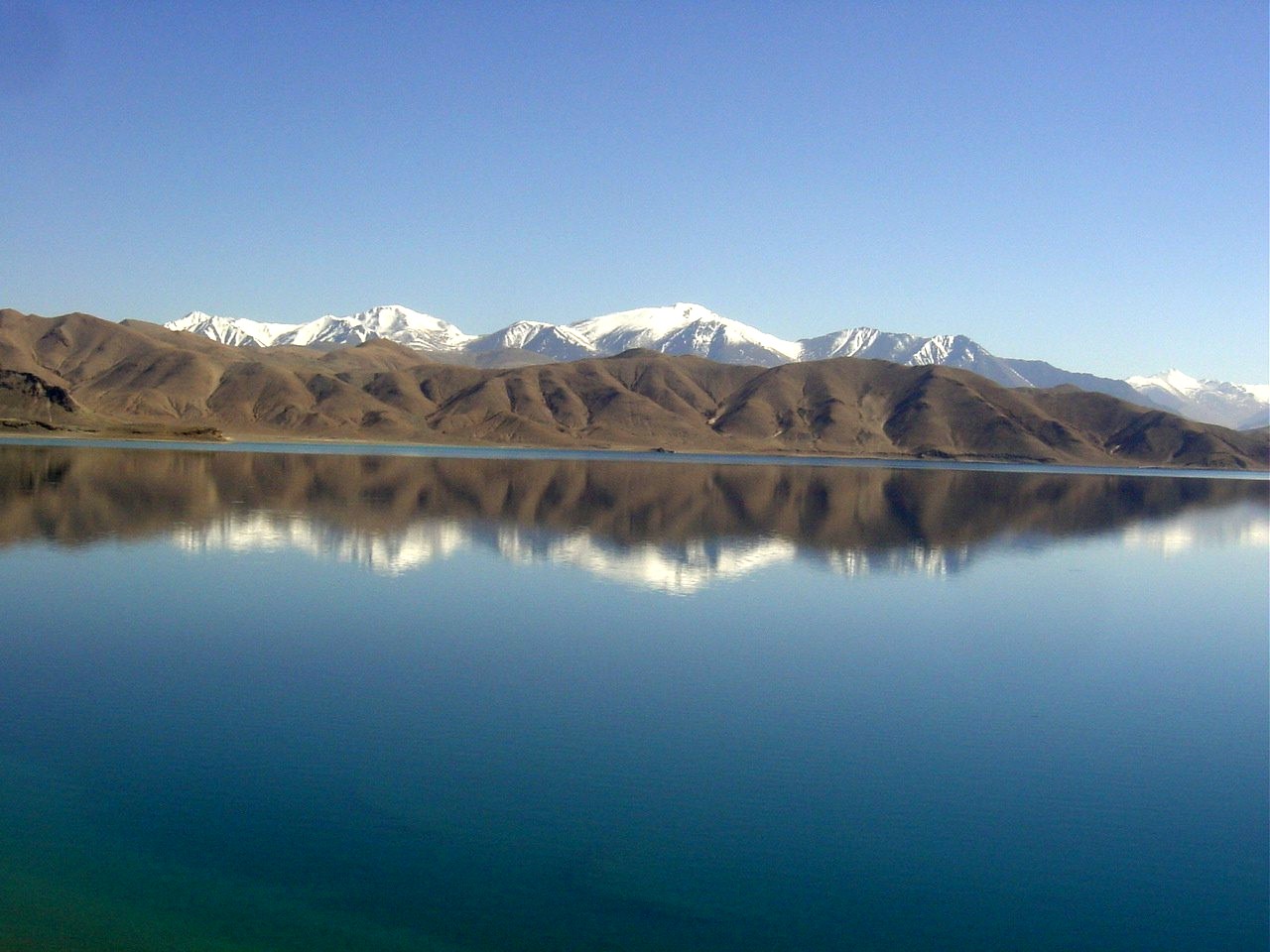
We reach the oasis of Korla on our travels along the northern Silk Road. Here at Iron Gate Pass is a 700-year-old inspection gate on a small gravel road that all caravans had to use on the way to Turfan. Korla offers the nearby Boston Lake as a tourist attraction. It seems to us like in another world: stands, motor boats, swimmers and sun umbrellas - a 1,000 kilometer sweet water lake in the middle of the desert.
 Iron Gate |
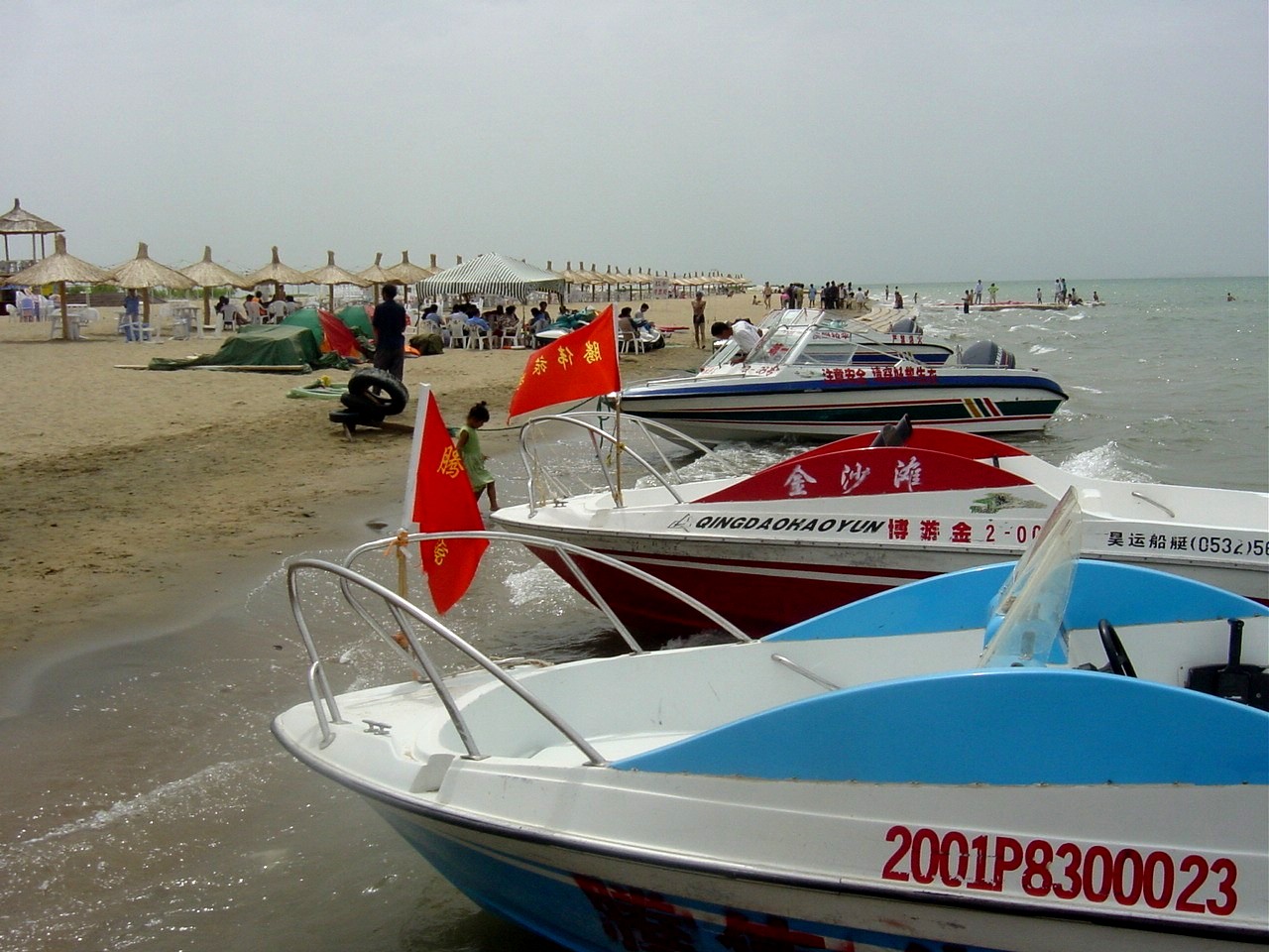 Boston Lake |
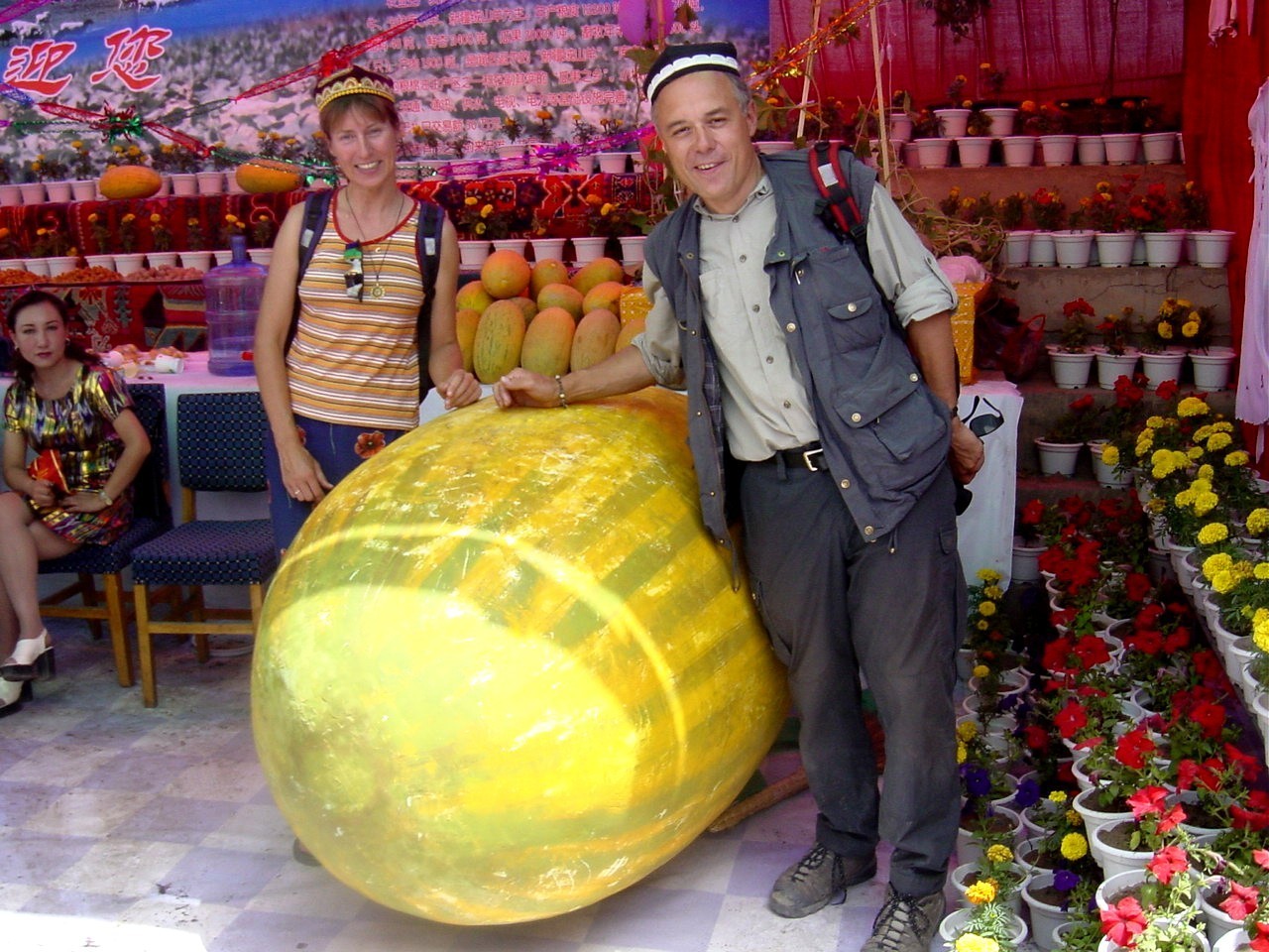
We want to stay the next four days in the oasis city of Turfan, the second lowest point on earth at 154 meters below see-level. Turfan is also called the City of Grapes and you can see them everywhere. We were looking forward to an evening meal with a good Chinese wine, but the grapes are mainly dried here and the raisins exported to all over the world. But at 40°C it is also pleasant to sit under the shady vines and enjoy a nice cool beer.
Our sightseeing program doesn' t let up and we take in the ruins of Gaochang and Jiaohe - ancient kingdoms on the Silk Road - Buddhist grottoes with wall paintings, graveyards and the famous Emin Minaret.
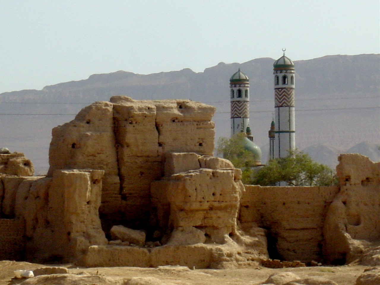 The ruins of Gaochang |
With temperatures of over 45°C in the shade our air-conditioning has become the most important part of our vehicle. The inhabitants in the green oasis city of Turfan have for over 2,000 years been provided with necessary water in this heat and dryness. In practice the Karez System pipes melt water from the nearby Tian Shan Mountains underground and it comes to Turfan cool and refreshing. It provides the population with drinking water and irrigation for their fields. Unfortunately, the channels are not being restored and because resources are becoming rare the electric pump is being used to pump the drinking water. The Karez System is beside the „Great Wall of China„ one of three most famous constructions of China.
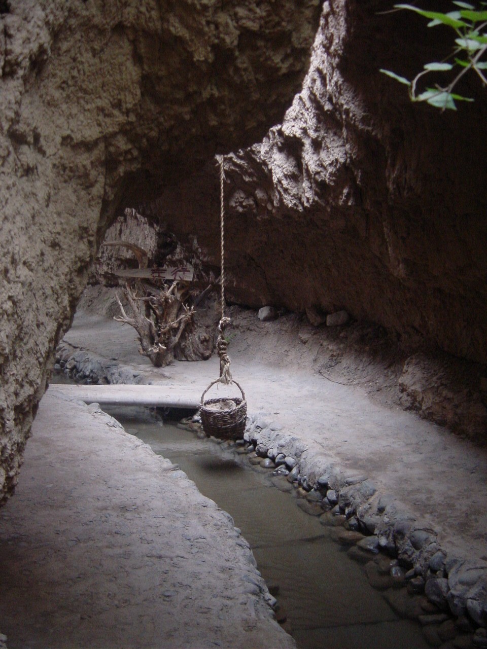 Karez System |
We settle the auto repair problem in Turfan. Our broken roof brackets are soldered. It isn' t exactly easy to find someone who can solder aluminum here. Our spare parts finally arrive from Germany. Chinese customs held them for a week in Shanghai. With many telephone calls and the help of a Chinese company that has an import license for auto parts we could solve the problem.
Without the cracking sound coming from the front axis that we had gotten used to we drive through the offshoot of the Gobi Desert to Dunhuang, the most eastern point of our journey. We have driven 15,000 kilometers since we left Bombay.
 Desert at the end of the road |
Once one had left the Jade Gate Pass with the huge „Gateway to the West„ behind them, the caravans then entered the wild and unfriendly territory of the Taklan Makan Desert on the way to Kashgar.
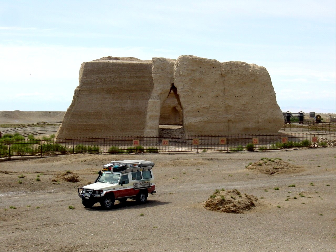 The Jade Gate |
The 5,000-kilometer long Great Wall of China that provided protection against attacks from the Huns and the Mongols out of the north reaches all the way to Dunhuang. We too follow along the ruins of the Chinese Wall. Its line runs dead straight through the desert. Now and again we have to cross over the wall ruins, which triggers special feelings in us. How many people can say they drove right over the Great Wall of China? On the way we come across signal towers separated by a great distance whose job it was to warn the caravans of danger or signal their direction with smoke and fire. An enemy attack would be messaged to the emperor within 24 hours by this „telecommunications system.„
 The Great Wall of China |
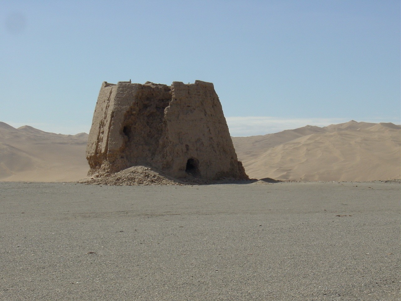 Signal tower |
Naturally Buddhism has left its influences in Dunhuang. In 1899 a Chinese monk discovered the buried Mogao Grottoes with its over 1,000 caves. This initiated a storm amongst foreign Central Asia researchers to excavate this place. Many scripts, sculptures and frescoes are found in foreign museums giving the Chinese the feeling that they have been robbed of their own ancient culture. In 1949 the remaining 492 caves were placed under historical protection by the Chinese government and therefore hindered its destruction during the Cultural Revolution. The 35-meter high Buddha statue especially impressed us. As almost everywhere in China picture-taking at sightseeing sites is unfortunately forbidden, which is really too bad.
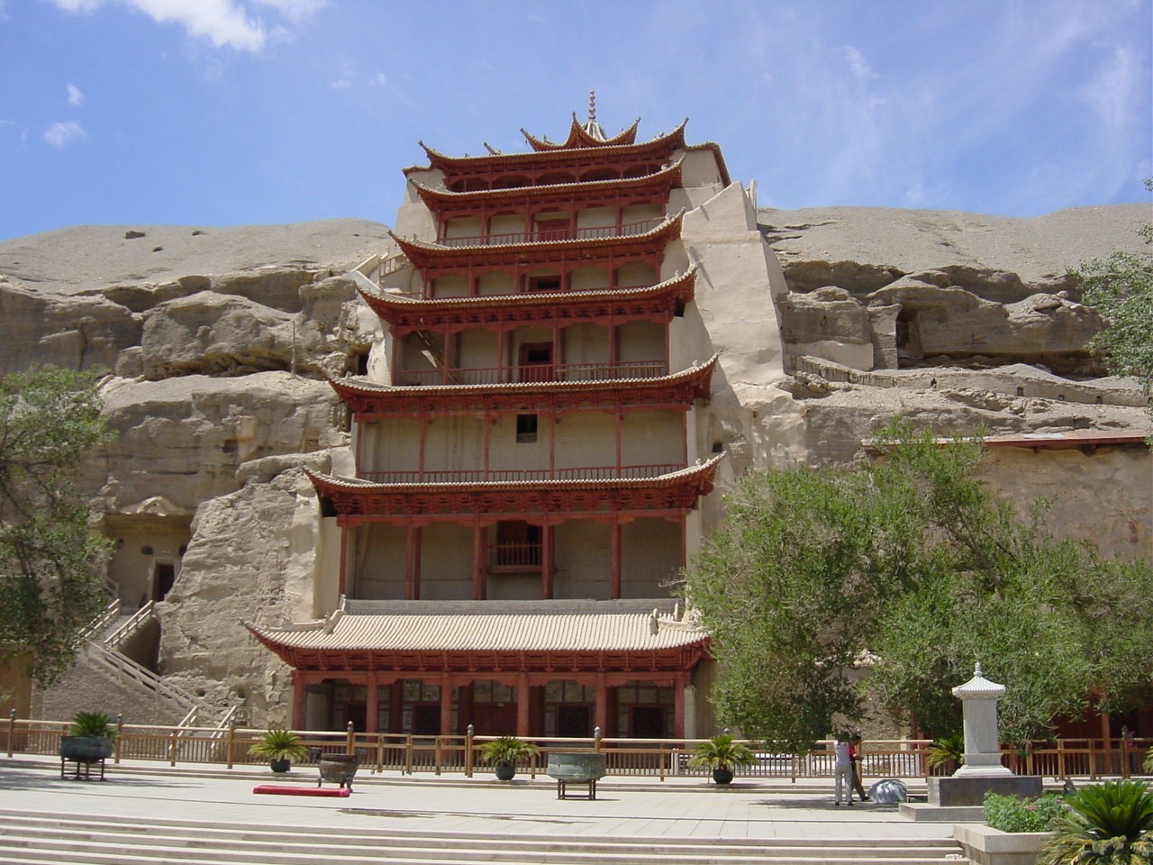 Mogao Grottoes |
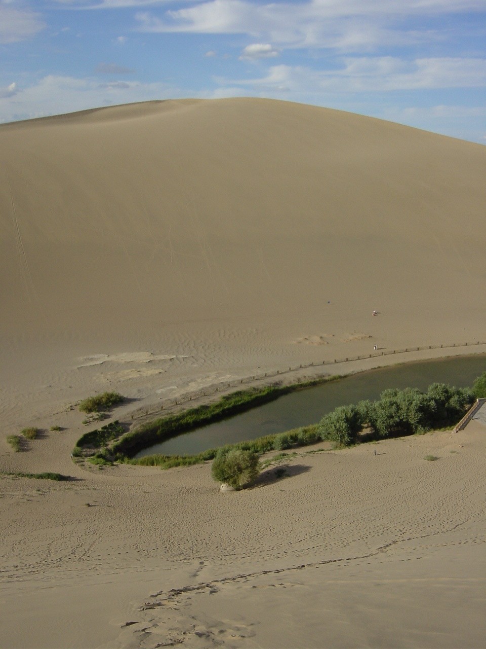
Last but not least we visit Crescent Moon Lake situated in the middle of the dunes that for over 1,500 years has miraculously remained unburied by sand. The Chinese have developed this place into a „Desert Theme Park„ which we feel is not exactly respectful of this spectacular natural wonder.
Our trail should lead us after four rejuvenating days on the southern route of the Silk Road over 2,300 kilometers back to Kashgar.
 Crescent Moon Lake |
 Southern Silk Road 1 |
 Southern Silk Road 2 |
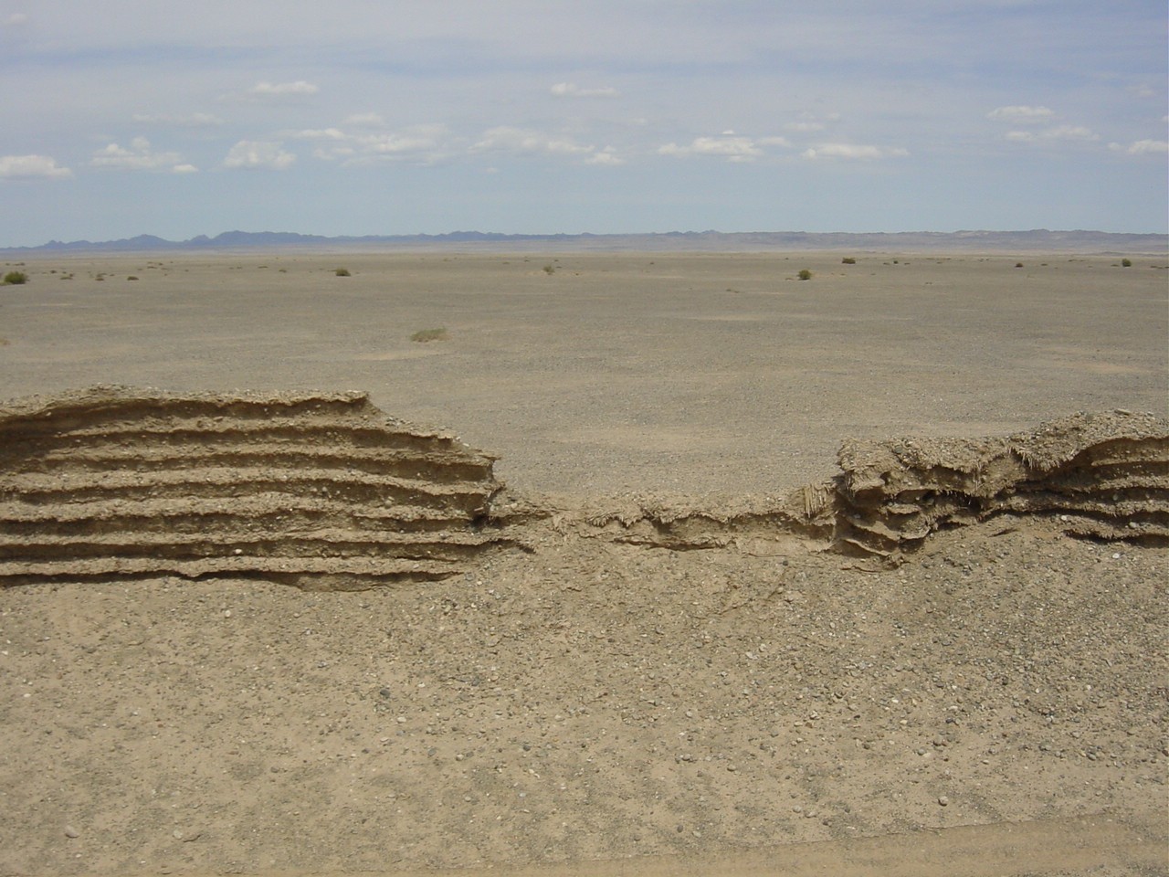
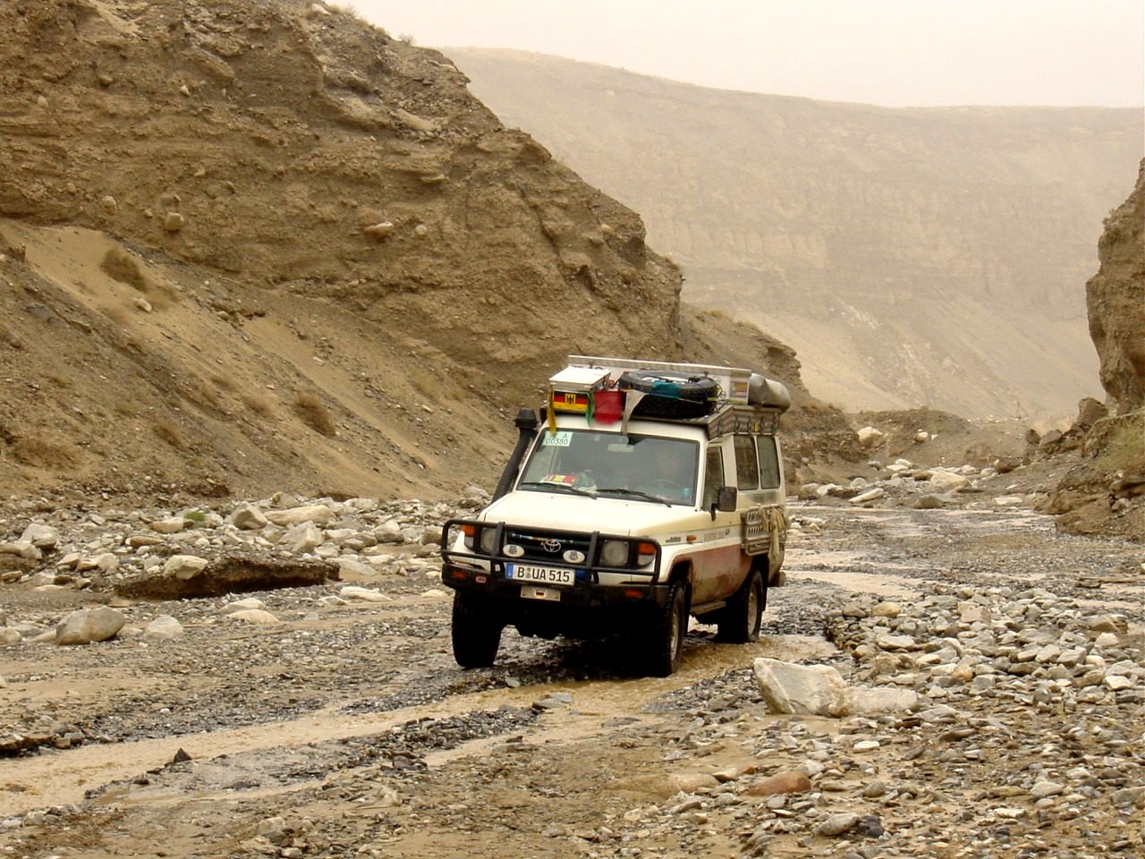
Shortly after Dunhuang we cross the Altu Shan Mountains, a mountain range with up to 5,800-meter high peaks, and drive over the Dangjin Shanou Pass (3,650 meters). The green mountains, the many flowers and the refreshing 15°C do us good. For today according to our travel schedule our goal has been reached and according to our GPS we are in a place called Lenghu. But what we find is a ghost town. All the houses are dilapidated with no windows and roofs. Modern ruins - but where will we lodge? The asphalt runs out just after Huatugou and again we drive over a bumpy trail with the usual sharp-edged „tire-killer stones„. We watch how the profiles of our Goodrich tires disintegrate by the kilometer. We have two flats in the space of 50 kilometers, which is too much for comfort. Shortly after the trail disappears completely and we are driving off-road through a riverbed and canyon again. Now and again we find ourselves on the trail again but for the most part it is under a hefty mudslide. We' re glad that there is currently so little water in the river valley.
 Asphalt (still) |
 National Road #315 1 |
 National Road #315 2 |
You meet other than abandoned vehicles just about nobody in this deserted area; we pull a car out of the mud, give help with our tools or take stranded people along with us. We had to air out the land cruiser when our last hitchhiker smelled as rank as his goats.
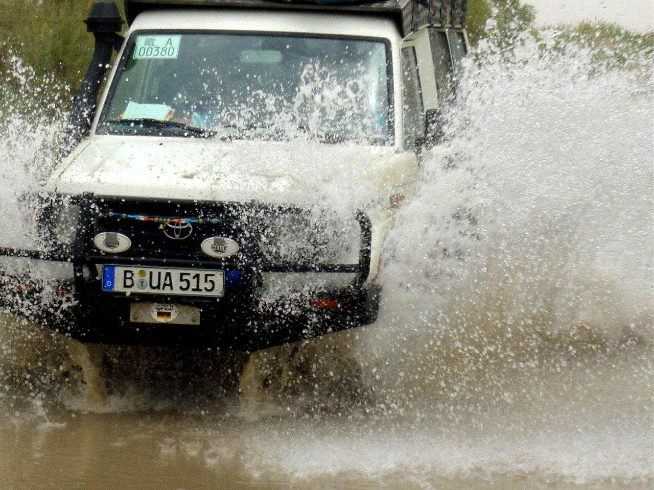
Because of heavy rainfall and the melt water from the Kunlun Mountains many sections of the road has changed into a river. Just on the section from Ruoquang to Qiemo we were able to experience this live. In the middle of the desert we stand at a raging river, hemmed in on both sides by huge mud puddles. There are no tracks through the mud and we take our time thinking if we' ll make it through. Ute cautiously tests by foot the nature of the subsoil. Because she hasn' t sunk into the mud or was swept away by the raging river we decide to risk it - a silent prayer, 4-wheel drive operation switched on and differential blocked and through! The mud flies three meters high and as we reach the other side and feel hard desert sand under the tires, our land cruiser looks like it is festooned with stalactites. The bus on the other side doesn' t want to risk it and will wait until the mud is drier. If he' s still waiting to cross today we' ll never know.
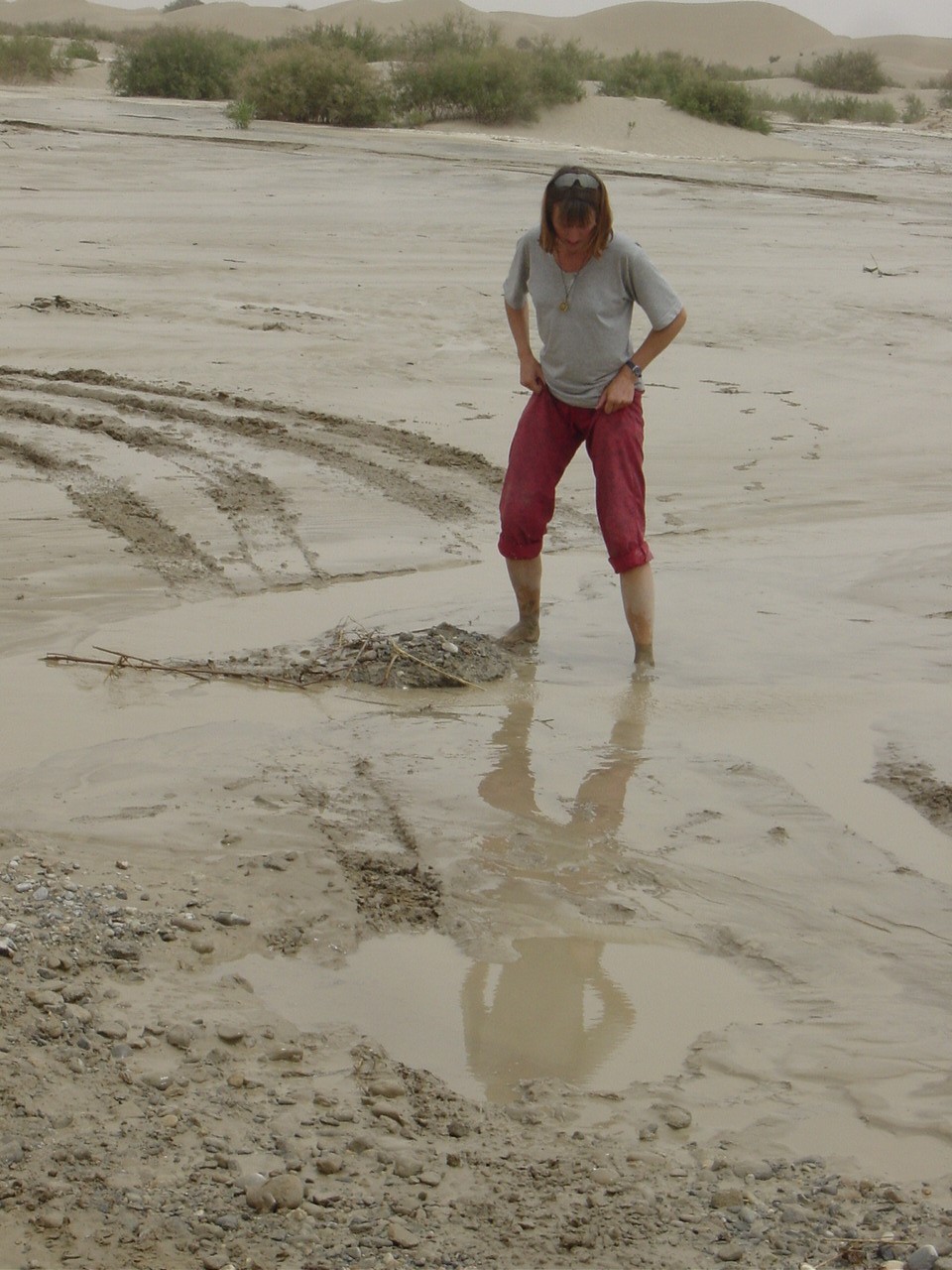 Mud tester |
 Mud fight |
 Water crossing |
Despite all the warnings we have the feeling that water is our public enemy number one during our journey through the desert and not the most feared sandstorm. We experience the announced sandstorms luckily enough in a very weakened form. Consequently, the road is either swept away or under water after a flood and the desert sand must be carefully shoveled off the road.
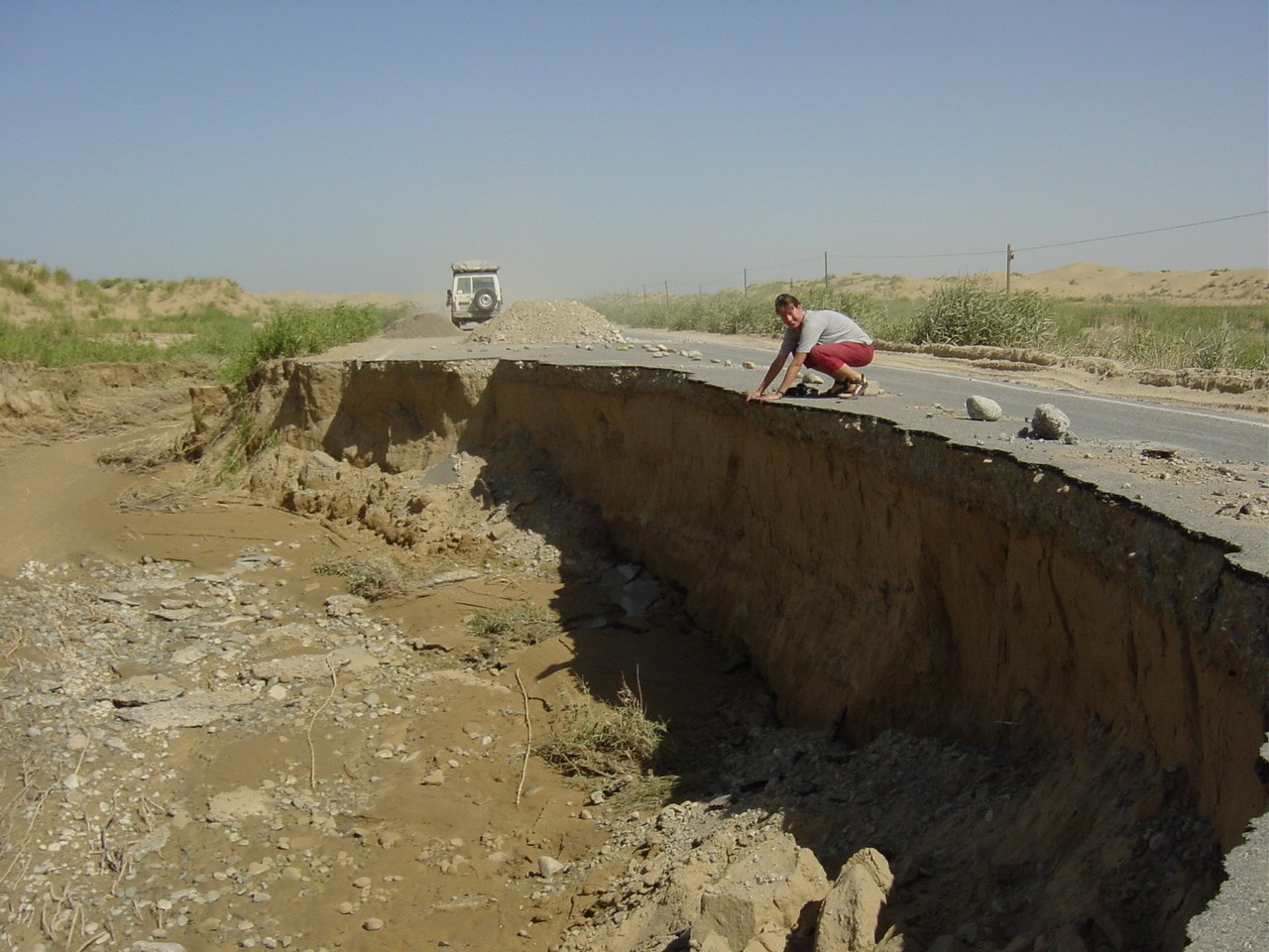 Road drop out |
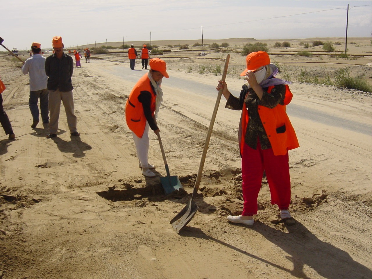 Shoveling sand |
After almost 2,000 kilometers we arrive at Hotan, an oasis town that became known for its jade. Also the secret of the production of silk was brought to the west through the marriage between a Chinese princess and the king of Hotan. We visit the traditional family business of Mr. Abu Dourishiti in Jiya. Everything here is done by hand - from raising the silk worms to producing the silk. In the end we do buy four meters of silk because ultimately one cannot have been on the Silk Road without having brought home some silk.
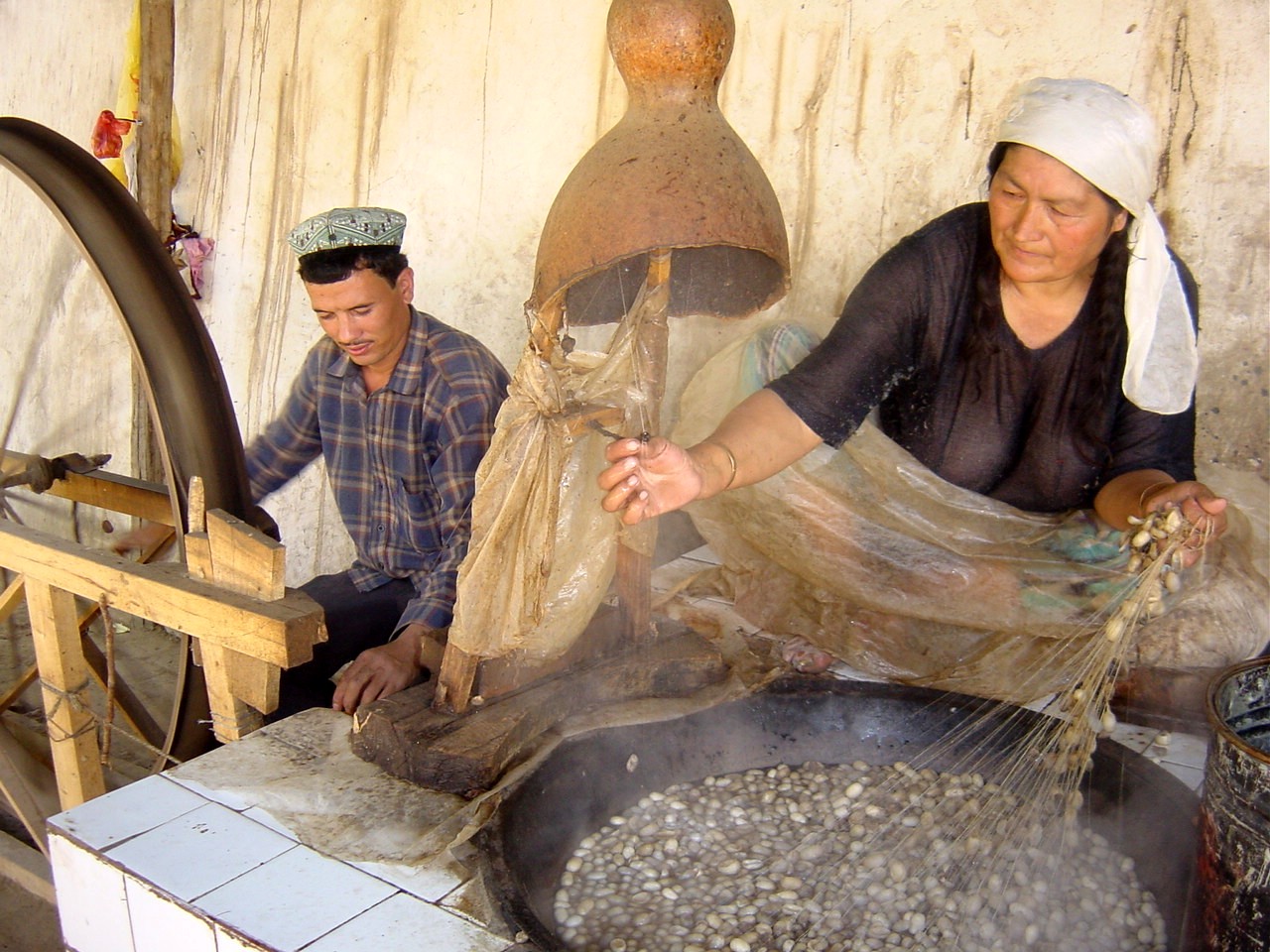 Silk production |
After 5,500 kilometers we close the circuit of our tour by ending up again in Kashgar. We have circled the Takla Makan. We bemoan three additional flat tires and the brand new bumper is crumpled again. We take the opportunity to purchase here four Chinese-produced tires and are relieved to be able to leave our badly made American tires to a shoemaker at the bazaar. On the 19th of July we plan to drive over the Torugart Pass (3,752 meters) to Kyrgystan in Central Asia.
The arrival in China was made possible with numerous permits and going through bureaucratic barriers. We had heard many stories about corruption so that we came with a healthy portion of suspicion. Luckily we' ve experienced nothing of the sort. The police and the army had always correctly dealt with us - in all severity.
We found it interesting to observe in which direction the political and economical China would go. Even though everywhere you look are the insignias of communism, such as the red flags, stars and monuments, they are however mercilessly mixed with the brand names of capitalism. In the same neighborhood next to old squalid state factories highly modern, market-economy run factories are being erected. The old system is slowly being dissolved and replaced by the „new socialist way.„ In a country the size of China it will certainly require some time.
The government has also recognized that China' s reputation in the world is not the best and influenced by an obsolete political philosophy. The rest of the world, and especially the western media, have simply ignored the efforts that were made for more openness and tolerance in the last five years. In order to help this image change an American advertising agency has been commissioned for a worldwide campaign for a „New China„.
We enjoyed China and even when we' ve - apart from Tibet - only had the opportunity to experience Xinjiang. Now we say farewell or a Uiguren „hosh„ from this interesting part of the world.
 The changing China |